RESEARCH PROJECT:
INTERSECTIONAL GIS MAPPING
These GIS maps reveal spatial segregation patterns at the city scale that affect the urban experiences of nonhegemonic communities. They do so by mapping demographic distributions and adopting an intersectional framework originally developed by Black feminist scholars. This framework considers multiple and interacting markers of social oppression, such as immigration date, generation and refugee status, nationality, ethnicity, gender, and economic security.
Case-study: Ottawa-Gatineau, Canada
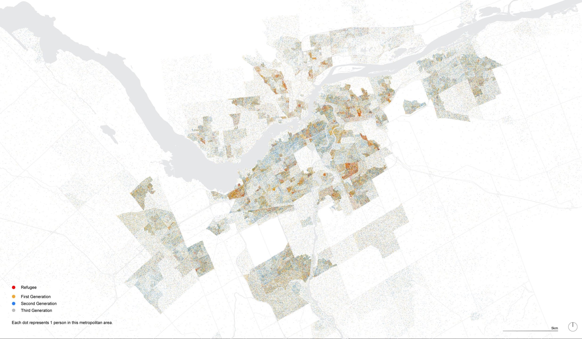
Urban distribution of Immigrant populations per generation and refugee status, Ottawa-Gatineau, Canada. (CC: All rights reserved )
Natalia Escobar Castrillon with Stefano Romagnoli (Region Austral)
Published at: Escobar, N. “Undoing White Settler Designed Cities: Mapping with Racialized Immigrant and Refugee Women in Canada,” ACSA 112th Annual Meeting: Disrupters on the Edge Proceedings, Vancouver, 2024.

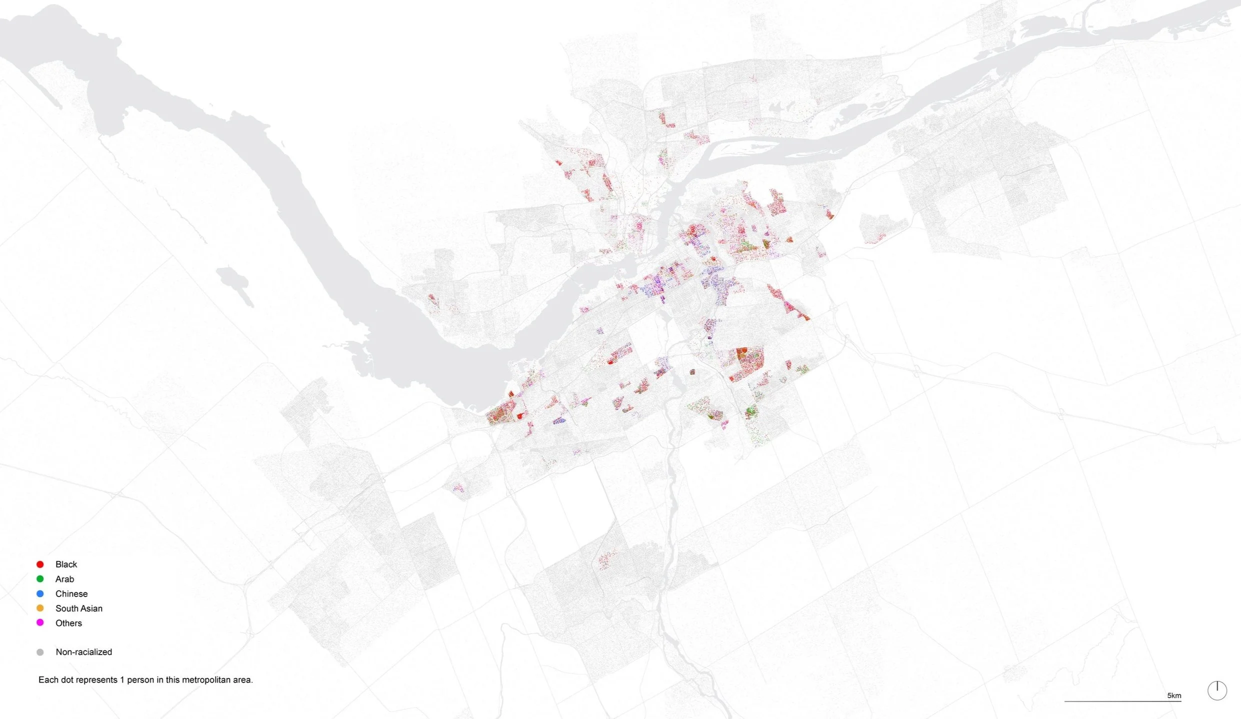
Urban Distribution of racialized women, Ottawa-Gatineau, Canada. (CC: All rights reserved)
Natalia Escobar Castrillon with Stefano Romagnoli (Region Austral)
Published at: Escobar, N. “Undoing White Settler Designed Cities: Mapping with Racialized Immigrant and Refugee Women in Canada,” ACSA 112th Annual Meeting: Disrupters on the Edge Proceedings, Vancouver, 2024.
Urban Distribution of racialized women in areas of high economic insecurity (20% low-income census cut-off), Ottawa-Gatineau, Canada. (CC: All rights reserved)
Natalia Escobar Castrillon with Stefano Romagnoli (Region Austral)
Published at: Escobar, N. “Undoing White Settler Designed Cities: Mapping with Racialized Immigrant and Refugee Women in Canada,” ACSA 112th Annual Meeting: Disrupters on the Edge Proceedings, Vancouver, 2024.
Supported by Carleton University an the non-profit organization the Inter-American Development Bank